Opua Bay Area, Opua Bay Postcode & Map in Opua Bay
Opua Bay Area, Opua Bay Postcode & Map in Opua Bay, Marlborough District, New Zealand
Opua Bay, Marlborough District, New Zealand
Opua Bay Area (estimated)
0.4 square kilometersOpua Bay Population (estimated)
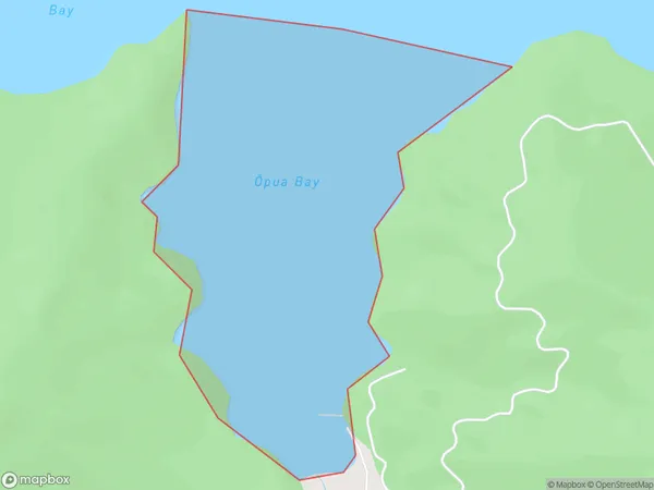
0 people live in Opua Bay, Marlborough, NZOpua Bay Suburb Area Map (Polygon)
Opua Bay Introduction
Opua Bay is a picturesque and safe bay located in Marlborough, New Zealand. It is known for its clear waters, sandy beaches, and stunning coastal scenery. The bay is a popular spot for swimming, boating, and fishing, and it is also home to a variety of wildlife, including seals, dolphins, and penguins.Region
Suburb Name
Opua Bay (Maori Name: Ōpua Bay)Other Name(s)
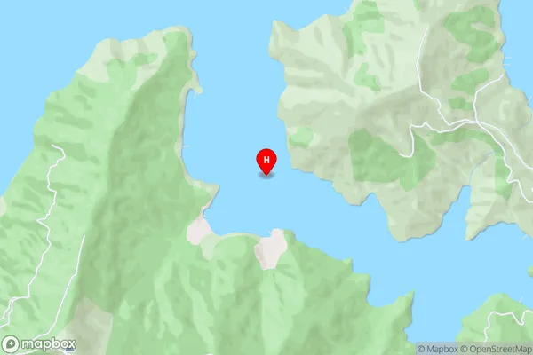
Onapua Bay, Queen Charlotte Sound (Totaranui)Opua Bay Area Map (Street)
Local Authority
Marlborough DistrictFull Address
Opua Bay, Marlborough District, New ZealandAddress Type
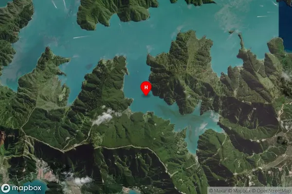
Coastal BayOpua Bay Suburb Map (Satellite)
Country
Main Region in AU
MarlboroughOpua Bay Region Map

Coordinates
-41.2614554,174.1850214 (latitude/longitude)Distances
The distance from Opua Bay, , Marlborough District to NZ Top 10 Cities