Kumara Junction Area, Kumara Junction Postcode(7832) & Map in Kumara Junction
Kumara Junction Area, Kumara Junction Postcode(7832) & Map in Kumara Junction, Westland District,
Kumara Junction, Westland District,
Kumara Junction Postcodes
Kumara Junction Area (estimated)
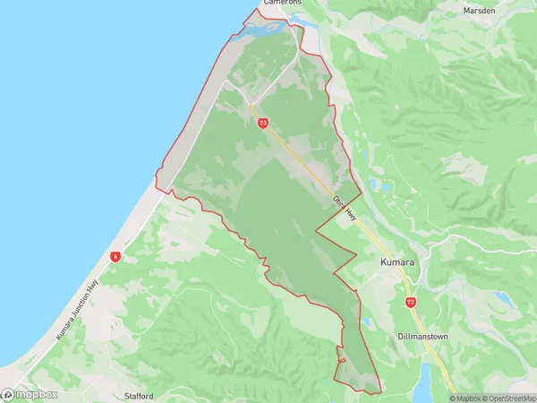
44.7 square kilometersKumara Junction Population (estimated)
212 people live in Kumara Junction, Greymouth, NZKumara Junction Suburb Area Map (Polygon)
Kumara Junction Introduction
Kumara Junction is a small town located in the West Coast region of New Zealand's South Island. It is situated at the junction of the Kumara and Grey Rivers and is known for its scenic surroundings, including the nearby Kumara National Park. The town has a population of around 500 people and is a popular stop for tourists traveling along the West Coast.Region
Major City
Suburb Name
Kumara JunctionKumara Junction Area Map (Street)
Local Authority
Westland DistrictFull Address
Kumara Junction, Westland District,Address Type
Suburb in Town GreymouthKumara Junction Suburb Map (Satellite)
Country
Main Region in AU
West CoastKumara Junction Region Map
Coordinates
0,0 (latitude/longitude)Distances
The distance from Kumara Junction, Greymouth, Westland District to NZ Top 10 Cities