Ngaio Bay Area, Ngaio Bay Postcode(0983) & Map in Ngaio Bay
Ngaio Bay Area, Ngaio Bay Postcode(0983) & Map in Ngaio Bay, Auckland, New Zealand
Ngaio Bay, Auckland, New Zealand
Ngaio Bay Postcodes
Ngaio Bay Area (estimated)
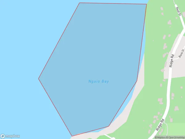
0.2 square kilometersNgaio Bay Population (estimated)
0 people live in Ngaio Bay, Rodney, NZNgaio Bay Suburb Area Map (Polygon)
Ngaio Bay Introduction
Ngaio Bay is a picturesque suburb in Auckland, New Zealand. It is known for its lush green parks, peaceful atmosphere, and stunning views of the surrounding countryside. The bay is a popular spot for swimming, sailing, and kayaking, and it is home to a variety of wildlife, including birds, fish, and seals. The area also has a rich history, with several historic buildings and landmarks, including the Ngaio Bush Reserve and the Ngaio Tree.Region
Major City
Suburb Name
Ngaio BayOther Name(s)
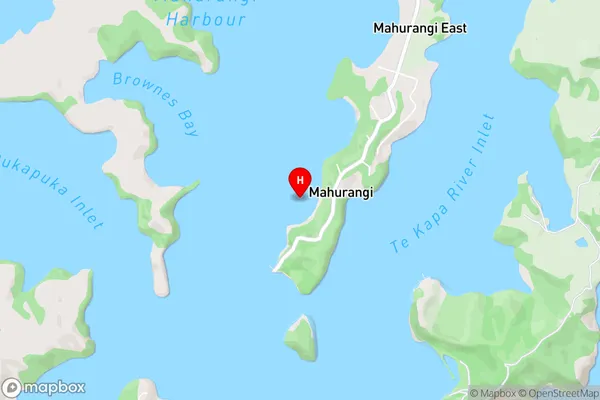
Mahurangi Harbour, Hauraki GulfNgaio Bay Area Map (Street)
Local Authority
AucklandFull Address
Ngaio Bay, Auckland, New ZealandAddress Type
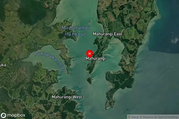
Coastal BayNgaio Bay Suburb Map (Satellite)
Country
Main Region in AU
AucklandNgaio Bay Region Map

Coordinates
-36.4808131,174.7259912 (latitude/longitude)Distances
The distance from Ngaio Bay, , Auckland to NZ Top 10 Cities