Moriori Bay Area, Moriori Bay Postcode & Map in Moriori Bay
Moriori Bay Area, Moriori Bay Postcode & Map in Moriori Bay, Marlborough District, New Zealand
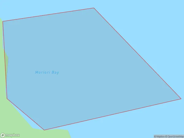
Moriori Bay, Marlborough District, New Zealand
Moriori Bay Area (estimated)
0.1 square kilometersMoriori Bay Population (estimated)
0 people live in Moriori Bay, Marlborough, NZMoriori Bay Suburb Area Map (Polygon)
Moriori Bay Introduction
Moriori Bay is a small, sheltered bay located in the Marlborough region of New Zealand's South Island. It is known for its beautiful beaches, rich cultural heritage, and stunning natural surroundings. The bay was named after the Moriori people, who were the indigenous inhabitants of the area before European settlement. Moriori Bay is a popular destination for tourists and locals alike, with many opportunities for swimming, fishing, hiking, and exploring the nearby Moriori Forest.Region
Suburb Name
Moriori BayOther Name(s)
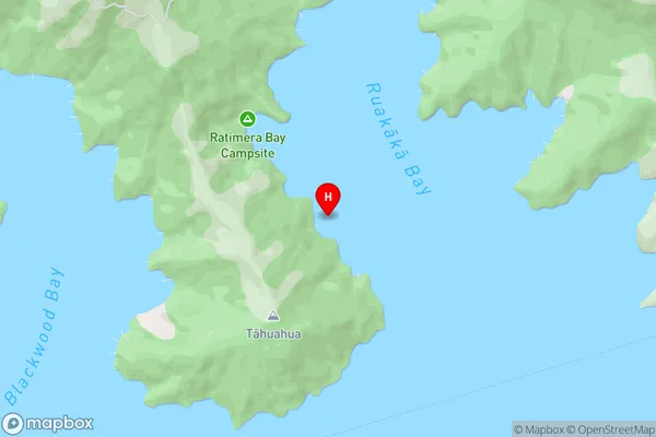
Ruakaka Bay, Queen Charlotte Sound (Totaranui) (Maori Name: Ruakākā Bay, Queen Charlotte Sound (Totaranui))Moriori Bay Area Map (Street)
Local Authority
Marlborough DistrictFull Address
Moriori Bay, Marlborough District, New ZealandAddress Type
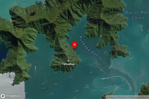
Coastal BayMoriori Bay Suburb Map (Satellite)
Country
Main Region in AU
MarlboroughMoriori Bay Region Map

Coordinates
-41.2104591,174.1189073 (latitude/longitude)Distances
The distance from Moriori Bay, , Marlborough District to NZ Top 10 Cities