Dinghy Cove Area, Dinghy Cove Postcode(9600) & Map in Dinghy Cove
Dinghy Cove Area, Dinghy Cove Postcode(9600) & Map in Dinghy Cove, Southland District, New Zealand
Dinghy Cove, Southland District, New Zealand
Dinghy Cove Postcodes
Dinghy Cove Area (estimated)
0.3 square kilometersDinghy Cove Population (estimated)
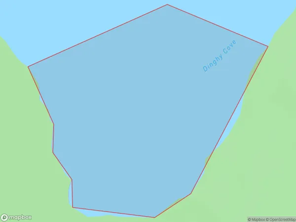
0 people live in Dinghy Cove, Fiordland Community, NZDinghy Cove Suburb Area Map (Polygon)
Dinghy Cove Introduction
Dinghy Cove is a small, secluded beach located in Fiordland National Park in Southland, New Zealand. It is known for its stunning natural beauty, including crystal-clear waters, rugged cliffs, and lush forests. The cove is a popular spot for swimming, kayaking, and hiking, and it is surrounded by breathtaking scenery. Dinghy Cove is also home to a small community of native birds, including kea and tui.Region
Major City
Suburb Name
Dinghy CoveOther Name(s)
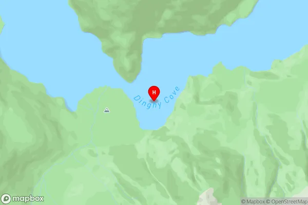
South Fiord, Lake Te AnauDinghy Cove Area Map (Street)
Local Authority
Southland DistrictFull Address
Dinghy Cove, Southland District, New ZealandAddress Type
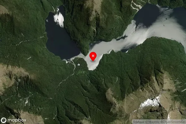
Inland BayDinghy Cove Suburb Map (Satellite)
Country
Main Region in AU
SouthlandDinghy Cove Region Map

Coordinates
-45.3124332,167.453709494679 (latitude/longitude)Distances
The distance from Dinghy Cove, , Southland District to NZ Top 10 Cities