Dicks Bay Area, Dicks Bay Postcode & Map in Dicks Bay
Dicks Bay Area, Dicks Bay Postcode & Map in Dicks Bay, Far North District, New Zealand
Dicks Bay, Far North District, New Zealand
Dicks Bay Area (estimated)
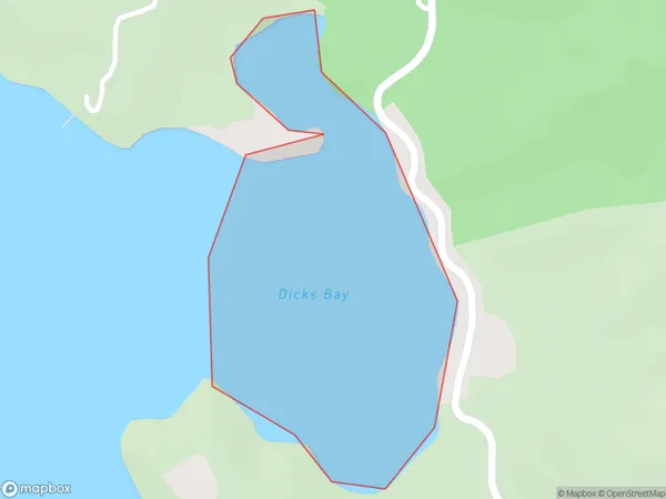
0.3 square kilometersDicks Bay Population (estimated)
0 people live in Dicks Bay, Bay of Islands-Whangaroa Community, NZDicks Bay Suburb Area Map (Polygon)
Dicks Bay Introduction
Dicks Bay is a bay in the Northland Region of New Zealand. It is located between the towns of Kaitaia and Opua, and is known for its scenic beauty and recreational opportunities, including fishing, kayaking, and hiking. The bay is also home to a small community of around 100 people.Region
Major City
Suburb Name
Dicks BayOther Name(s)
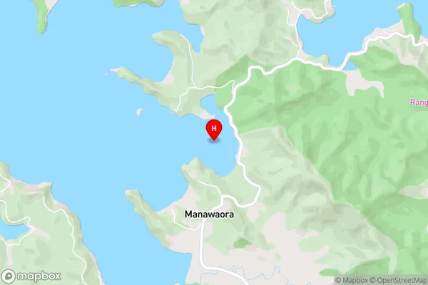
Te Huruhi Bay, Te Rawhiti Inlet, Bay Of IslandsDicks Bay Area Map (Street)
Local Authority
Far North DistrictFull Address
Dicks Bay, Far North District, New ZealandAddress Type
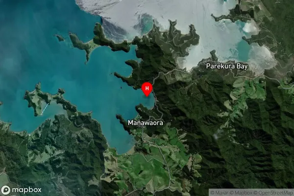
Coastal BayDicks Bay Suburb Map (Satellite)
Country
Main Region in AU
NorthlandDicks Bay Region Map

Coordinates
-35.2673344,174.215327 (latitude/longitude)Distances
The distance from Dicks Bay, , Far North District to NZ Top 10 Cities