Clendon Cove Area, Clendon Cove Postcode & Map in Clendon Cove
Clendon Cove Area, Clendon Cove Postcode & Map in Clendon Cove, Far North District, New Zealand
Clendon Cove, Far North District, New Zealand
Clendon Cove Area (estimated)
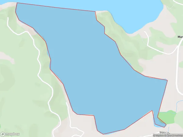
1.2 square kilometersClendon Cove Population (estimated)
0 people live in Clendon Cove, Bay of Islands-Whangaroa Community, NZClendon Cove Suburb Area Map (Polygon)
Clendon Cove Introduction
Clendon Cove is a small, secluded beach located in Northland, New Zealand. It is known for its crystal-clear waters, stunning coastal scenery, and peaceful atmosphere. The cove is surrounded by native bush and offers a range of activities such as swimming, snorkeling, and hiking. It is a popular destination for nature lovers and those seeking a quiet escape from the hustle and bustle of city life.Region
Major City
Suburb Name
Clendon CoveOther Name(s)
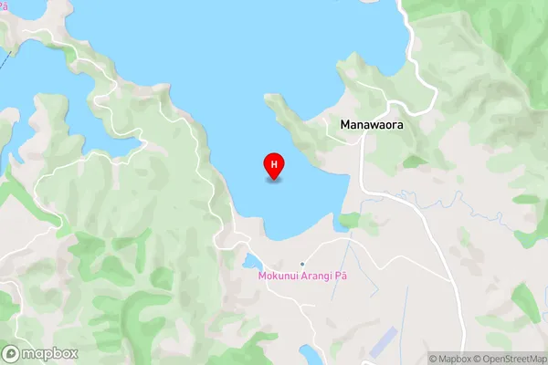
Te Rawhiti Inlet, Bay Of IslandsClendon Cove Area Map (Street)
Local Authority
Far North DistrictFull Address
Clendon Cove, Far North District, New ZealandAddress Type
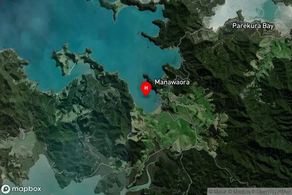
Coastal BayClendon Cove Suburb Map (Satellite)
Country
Main Region in AU
NorthlandClendon Cove Region Map

Coordinates
-35.2788349,174.2055705 (latitude/longitude)Distances
The distance from Clendon Cove, , Far North District to NZ Top 10 Cities