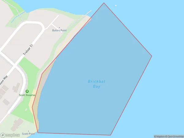
Brickbat Bay Area, Brickbat Bay Postcode(0618) & Map in Brickbat Bay
Brickbat Bay Area, Brickbat Bay Postcode(0618) & Map in Brickbat Bay, Auckland, New Zealand
Brickbat Bay, Auckland, New Zealand
Brickbat Bay Postcodes
Brickbat Bay Area (estimated)
0.1 square kilometersBrickbat Bay Population (estimated)
0 people live in Brickbat Bay, Upper Harbour, NZBrickbat Bay Suburb Area Map (Polygon)
Brickbat Bay Introduction
Brickbat Bay is a small, peaceful bay located in the Eastern suburbs of Auckland, New Zealand. It is known for its stunning natural beauty, including rugged cliffs, lush greenery, and crystal-clear waters. The bay is a popular spot for swimming, kayaking, and paddleboarding, and it is also home to a small community of residents who enjoy the peaceful and tranquil lifestyle. The bay is surrounded by picturesque farmland and is located within easy reach of the city center.Region
Major City
Suburb Name
Brickbat BayOther Name(s)
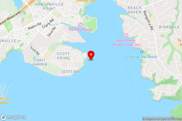
Waitemata Harbour, Hauraki Gulf (Maori Name: Waitematā Harbour, Hauraki Gulf)Brickbat Bay Area Map (Street)
Local Authority
AucklandFull Address
Brickbat Bay, Auckland, New ZealandAddress Type
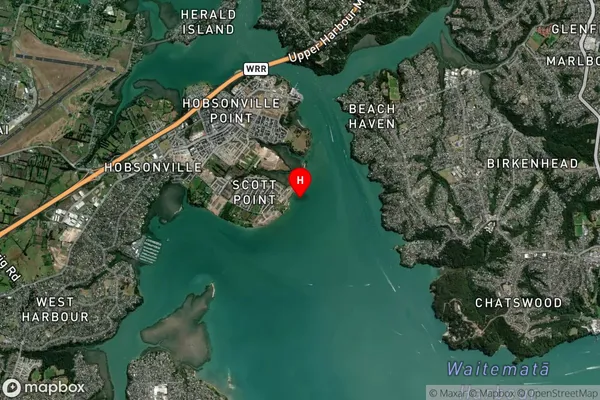
Coastal BayBrickbat Bay Suburb Map (Satellite)
Country
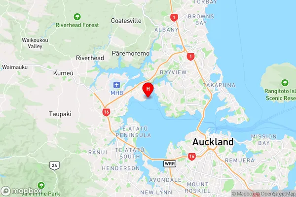
Main Region in AU
AucklandBrickbat Bay Region Map
Coordinates
-36.8037036,174.6726545 (latitude/longitude)Distances
The distance from Brickbat Bay, , Auckland to NZ Top 10 Cities