Russell Forest Area, Russell Forest Postcode & Map in Russell Forest, Far North District
Russell Forest Area, Russell Forest Postcode & Map in Russell Forest, Far North District, Whangarei District, New Zealand
Russell Forest, Far North District, Whangarei District, New Zealand
Russell Forest Area (estimated)
85.9 square kilometersRussell Forest Population (estimated)
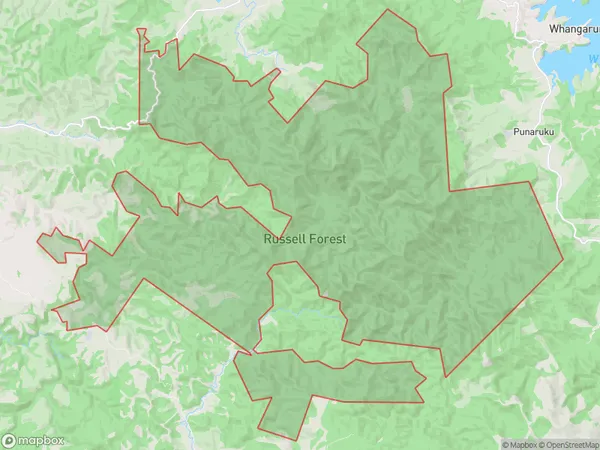
3 people live in Russell Forest, Northland, NZRussell Forest Suburb Area Map (Polygon)
Russell Forest Introduction
Russell Forest is a forest located in Northland, New Zealand, that is part of the Northland Conservation Park. It is known for its dense forest, waterfalls, and scenic hiking trails. The forest covers an area of approximately 1,200 hectares and is home to a variety of plant and animal species, including kauri trees, tui, and kea. The forest was established in the 1930s and is managed by the Department of Conservation.Region
0Suburb Name
Russell ForestRussell Forest Area Map (Street)

Local Authority
Far North District, Whangarei DistrictFull Address
Russell Forest, Far North District, Whangarei District, New ZealandAddress Type
Conservation Land in Major Locality Northland Conservation ParkRussell Forest Suburb Map (Satellite)

Country
Main Region in AU
NorthlandRussell Forest Region Map

Coordinates
-35.39471625,174.252192755284 (latitude/longitude)Distances
The distance from Russell Forest, Northland Conservation Park, Far North District, Whangarei District to NZ Top 10 Cities