Whatupuke Island Area, Whatupuke Island Postcode & Map in Whatupuke Island
Whatupuke Island Area, Whatupuke Island Postcode & Map in Whatupuke Island, Whangarei District, New Zealand
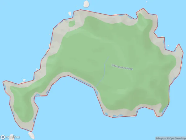
Whatupuke Island, Whangarei District, New Zealand
Whatupuke Island Area (estimated)
1.2 square kilometersWhatupuke Island Population (estimated)
0 people live in Whatupuke Island, Northland, NZWhatupuke Island Suburb Area Map (Polygon)
Whatupuke Island Introduction
Whatupuke Island is a small island located in the Bay of Islands, Northland, New Zealand. It is known for its stunning natural beauty, including lush forests, crystal-clear waters, and picturesque beaches. The island is a popular destination for tourists and is home to a small community of people who live off the land and sea.Region
Suburb Name
Whatupuke IslandOther Name(s)
Marotere Islands, Hen And Chicken Islands, Middle Chicken IslandWhatupuke Island Area Map (Street)

Local Authority
Whangarei DistrictFull Address
Whatupuke Island, Whangarei District, New ZealandAddress Type
IslandWhatupuke Island Suburb Map (Satellite)

Country
Main Region in AU
NorthlandWhatupuke Island Region Map

Coordinates
-35.89020875,174.754682956789 (latitude/longitude)Distances
The distance from Whatupuke Island, , Whangarei District to NZ Top 10 Cities