Taranga Island Area, Taranga Island Postcode & Map in Taranga Island
Taranga Island Area, Taranga Island Postcode & Map in Taranga Island, Whangarei District,
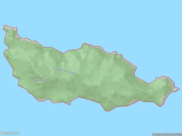
Taranga Island, Whangarei District,
Taranga Island Area (estimated)
5.9 square kilometersTaranga Island Population (estimated)
0 people live in Taranga Island, Brighton, NZTaranga Island Suburb Area Map (Polygon)
Taranga Island Introduction
Taranga Island is a small island located off the coast of Otago, New Zealand. It is known for its stunning natural beauty, including rugged cliffs, sandy beaches, and a variety of wildlife. The island is a popular destination for hiking, camping, and birdwatching, with over 100 species of birds recorded on the island. It is also home to a small community of people who live off the land and rely on fishing and farming for their livelihood.Region
Major City
Suburb Name
Taranga IslandOther Name(s)
Hen And Chicken Islands, Hen IslandTaranga Island Area Map (Street)
Local Authority
Whangarei DistrictFull Address
Taranga Island, Whangarei District,Address Type
IslandTaranga Island Suburb Map (Satellite)
Country
Main Region in AU
OtagoTaranga Island Region Map
Coordinates
0,0 (latitude/longitude)Distances
The distance from Taranga Island, , Whangarei District to NZ Top 10 Cities