Rosa Island Area, Rosa Island Postcode & Map in Rosa Island
Rosa Island Area, Rosa Island Postcode & Map in Rosa Island, Southland District, New Zealand
Rosa Island, Southland District, New Zealand
Rosa Island Area (estimated)
0.0 square kilometersRosa Island Population (estimated)
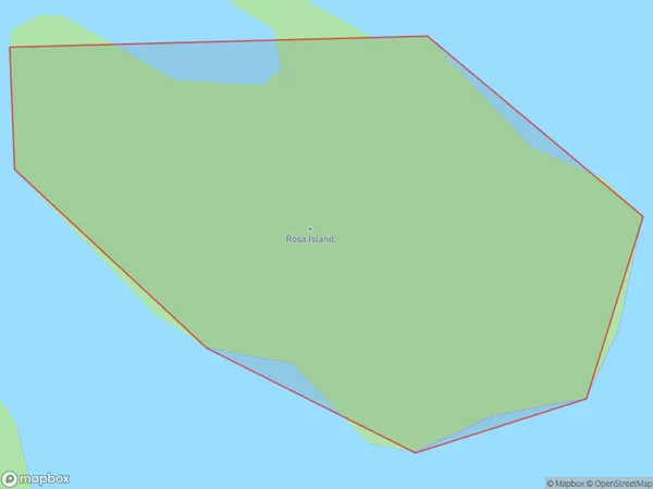
0 people live in Rosa Island, Southland, NZRosa Island Suburb Area Map (Polygon)
Rosa Island Introduction
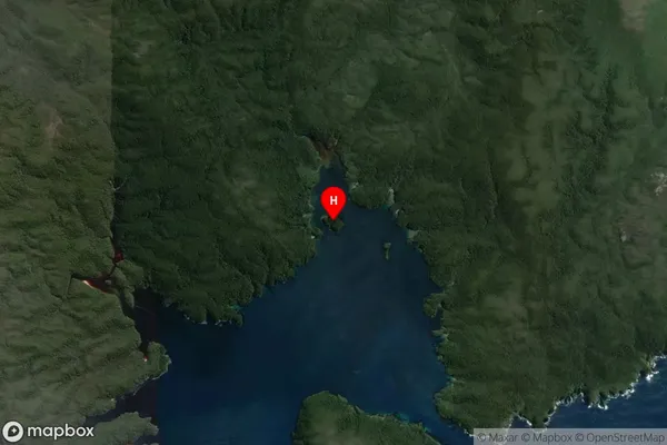
Rosa Island is a small, uninhabited island in Fiordland National Park, Southland, New Zealand. It is located in the southern part of the Fiordland region and is part of the Dusky Sound group of islands. The island is approximately 1.5 km long and 0.5 km wide and is surrounded by steep cliffs and dense forest. Rosa Island is a popular destination for day trips and overnight hikes, and it is known for its stunning natural beauty, including waterfalls, crystal-clear streams, and a variety of bird species.Region
Suburb Name
Rosa IslandOther Name(s)
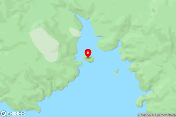
North ArmRosa Island Area Map (Street)
Local Authority
Southland DistrictFull Address
Rosa Island, Southland District, New ZealandAddress Type
IslandRosa Island Suburb Map (Satellite)
Country
Main Region in AU
SouthlandRosa Island Region Map

Coordinates
-47.1600302,167.7010577 (latitude/longitude)Distances
The distance from Rosa Island, , Southland District to NZ Top 10 Cities