Rerewhakaupoko Island / Solomon Area, Rerewhakaupoko Island / Solomon Postcode & Map in Rerewhakaupoko Island / Solomon
Rerewhakaupoko Island / Solomon Area, Rerewhakaupoko Island / Solomon Postcode & Map in Rerewhakaupoko Island / Solomon, Southland District, New Zealand
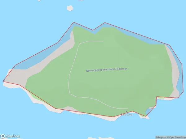
Rerewhakaupoko Island / Solomon, Southland District, New Zealand
Rerewhakaupoko Island / Solomon Area (estimated)
0.3 square kilometersRerewhakaupoko Island / Solomon Population (estimated)
0 people live in Rerewhakaupoko Island / Solomon, Southland, NZRerewhakaupoko Island / Solomon Suburb Area Map (Polygon)
Rerewhakaupoko Island / Solomon Introduction
Rerewhakaupoko Island / Solomon is a small island in the Foveaux Strait, Southland, New Zealand. It is part of the Solomon Islands and is home to the Rerewhakaaitu Marae and the Rerewhakaaitu Pa, a historic meeting place of the Southern Maori iwi. The island has a rich cultural heritage and is an important site for traditional Maori practices and ceremonies.Region
Suburb Name
Rerewhakaupoko Island / SolomonOther Name(s)
Titi / Muttonbird Islands, Rerewhakaupoko Island, Solomon (Maori Name: Tītī / Muttonbird Islands, Rerewhakaupoko Island, Solomon)Rerewhakaupoko Island / Solomon Area Map (Street)

Local Authority
Southland DistrictFull Address
Rerewhakaupoko Island / Solomon, Southland District, New ZealandAddress Type
IslandRerewhakaupoko Island / Solomon Suburb Map (Satellite)

Country
Main Region in AU
SouthlandRerewhakaupoko Island / Solomon Region Map

Coordinates
-47.2208639,167.435176222433 (latitude/longitude)Distances
The distance from Rerewhakaupoko Island / Solomon, , Southland District to NZ Top 10 Cities