Poikeke Island Area, Poikeke Island Postcode(3500) & Map in Poikeke Island
Poikeke Island Area, Poikeke Island Postcode(3500) & Map in Poikeke Island, Thames-Coromandel District, New Zealand
Poikeke Island, Thames-Coromandel District, New Zealand
Poikeke Island Postcodes
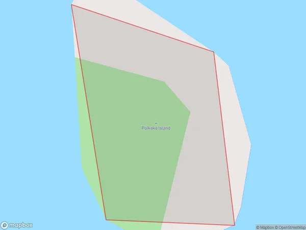
Poikeke Island Area (estimated)
0.0 square kilometersPoikeke Island Population (estimated)
0 people live in Poikeke Island, Waikato, NZPoikeke Island Suburb Area Map (Polygon)
Poikeke Island Introduction
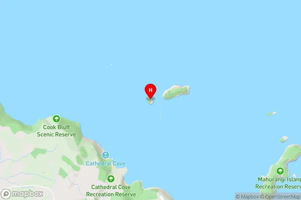
Poikeke Island is a small island in the Waikato River, north of Hamilton, New Zealand. It is known for its historic ruins, including a fort built by the British in the 1840s. The island is a popular destination for day trips and has a variety of wildlife, including birds, bats, and insects.Region
Suburb Name
Poikeke IslandPoikeke Island Area Map (Street)
Local Authority
Thames-Coromandel DistrictFull Address
Poikeke Island, Thames-Coromandel District, New ZealandAddress Type
IslandPoikeke Island Suburb Map (Satellite)

Country
Main Region in AU
WaikatoPoikeke Island Region Map

Coordinates
-36.8202769,175.797290481302 (latitude/longitude)Distances
The distance from Poikeke Island, , Thames-Coromandel District to NZ Top 10 Cities