Pearl Island Area, Pearl Island Postcode & Map in Pearl Island
Pearl Island Area, Pearl Island Postcode & Map in Pearl Island, Southland District, New Zealand
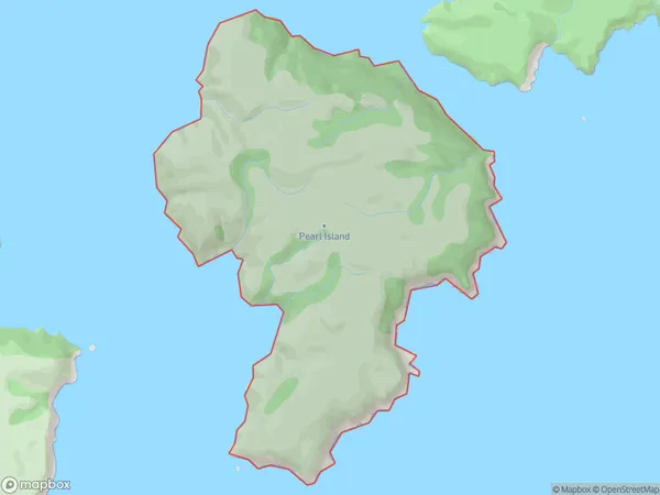
Pearl Island, Southland District, New Zealand
Pearl Island Area (estimated)
6.1 square kilometersPearl Island Population (estimated)
0 people live in Pearl Island, Southland, NZPearl Island Suburb Area Map (Polygon)
Pearl Island Introduction
Pearl Island is a small, uninhabited island in Fiordland National Park, Southland, New Zealand. It is known for its stunning natural beauty, including lush forests, crystal-clear lakes, and breathtaking waterfalls. The island is accessible by a short boat ride from the town of Milford Sound. It has been a popular filming location for movies such as "The Hobbit" and "The Lord of the Rings."Region
Suburb Name
Pearl IslandPearl Island Area Map (Street)

Local Authority
Southland DistrictFull Address
Pearl Island, Southland District, New ZealandAddress Type
IslandPearl Island Suburb Map (Satellite)

Country
Main Region in AU
SouthlandPearl Island Region Map

Coordinates
-47.1934909,167.708936282681 (latitude/longitude)Distances
The distance from Pearl Island, , Southland District to NZ Top 10 Cities