Papakuri Island Area, Papakuri Island Postcode(0622) & Map in Papakuri Island
Papakuri Island Area, Papakuri Island Postcode(0622) & Map in Papakuri Island, Auckland, New Zealand
Papakuri Island, Auckland, New Zealand
Papakuri Island Postcodes
0Papakuri Island Population (estimated)
0 people live in Papakuri Island, Aotea Great Barrier, NZ0Papakuri Island Introduction
Papakuri Island is a small, uninhabited island located in the Hauraki Gulf, just off the coast of Auckland, New Zealand. It is known for its stunning natural beauty, including rugged cliffs, sandy beaches, and lush forests. The island is a popular destination for hiking, camping, and wildlife watching, with a variety of bird species and occasional visits from seals and dolphins. It is also home to a small community of native birds, including the rare New Zealand kiwi.Region
Major City
Suburb Name
Papakuri IslandOther Name(s)
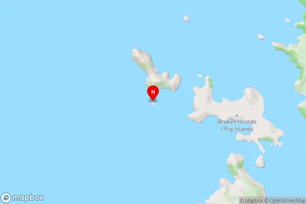
Broken Islands (Pig Islands), Hauraki GulfPapakuri Island Area Map (Street)
Local Authority
AucklandFull Address
Papakuri Island, Auckland, New ZealandAddress Type
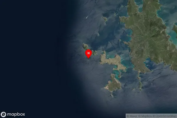
IslandPapakuri Island Suburb Map (Satellite)
Country
Main Region in AU
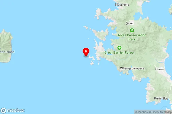
AucklandPapakuri Island Region Map
Coordinates
-36.22031765,175.2886055625 (latitude/longitude)Distances
The distance from Papakuri Island, , Auckland to NZ Top 10 Cities