Maud Island Area, Maud Island Postcode & Map in Maud Island
Maud Island Area, Maud Island Postcode & Map in Maud Island, Marlborough District,
Maud Island, Marlborough District,
Maud Island Area (estimated)
3.8 square kilometersMaud Island Population (estimated)
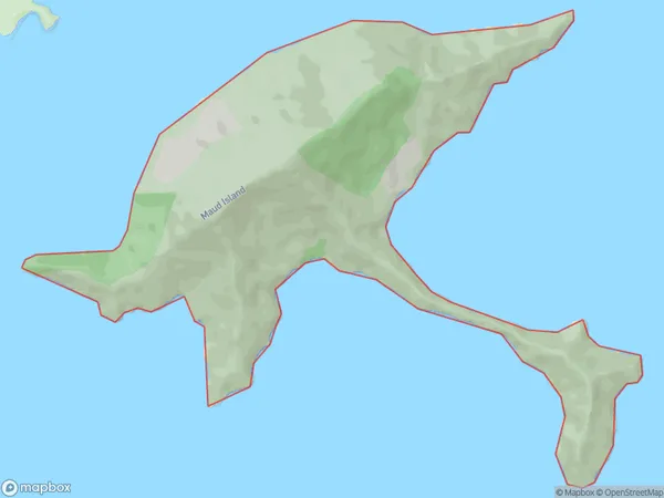
0 people live in Maud Island, , NZMaud Island Suburb Area Map (Polygon)
Maud Island Introduction
Maud Island is located in the Marlborough Sounds, New Zealand. It is a small island with a population of around 50 people. The island is known for its scenic beauty, including lush forests, crystal-clear waters, and stunning beaches. Maud Island is also home to a variety of wildlife, including seals, penguins, and birds. The island has a rich history, with evidence of human settlement dating back to the early 19th century. Visitors to Maud Island can explore the island on foot, by boat, or by helicopter. There are also several accommodation options on the island, including a lodge and a campground.0Suburb Name
Maud IslandOther Name(s)
Te HoiereMaud Island Area Map (Street)
Local Authority
Marlborough DistrictFull Address
Maud Island, Marlborough District,Address Type
Island in Major Locality Marlborough SoundsMaud Island Suburb Map (Satellite)
Country
Main Region in AU
Maud Island Region Map
Coordinates
0,0 (latitude/longitude)Distances
The distance from Maud Island, Marlborough Sounds, Marlborough District to NZ Top 10 Cities