Long Island Area, Long Island Postcode & Map in Long Island
Long Island Area, Long Island Postcode & Map in Long Island, Southland District, New Zealand
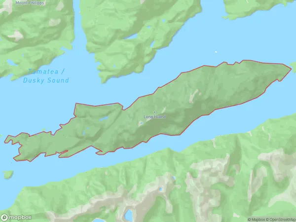
Long Island, Southland District, New Zealand
Long Island Area (estimated)
22.7 square kilometersLong Island Population (estimated)
0 people live in Long Island, Southland, NZLong Island Suburb Area Map (Polygon)
Long Island Introduction
Long Island is a small, uninhabited island in Fiordland National Park, Southland, New Zealand. It is located in the southern part of Fiordland, between the Dusky Sound and the Tasman Sea. The island is known for its stunning natural beauty, including rugged mountains, dense forests, and crystal-clear lakes. Long Island is a popular destination for hiking, camping, and wildlife viewing, with a variety of hiking trails and campgrounds available. The island is also home to a small population of Fiordland crested penguins, which are the only penguin species to breed in New Zealand.Region
Suburb Name
Long IslandOther Name(s)
Tamatea / Dusky SoundLong Island Area Map (Street)

Local Authority
Southland DistrictFull Address
Long Island, Southland District, New ZealandAddress Type
IslandLong Island Suburb Map (Satellite)

Country
Main Region in AU
SouthlandLong Island Region Map

Coordinates
-46.0948501,166.696284362544 (latitude/longitude)Distances
The distance from Long Island, , Southland District to NZ Top 10 Cities