Lee Island Area, Lee Island Postcode(9600) & Map in Lee Island
Lee Island Area, Lee Island Postcode(9600) & Map in Lee Island, Southland District, New Zealand
Lee Island, Southland District, New Zealand
Lee Island Postcodes
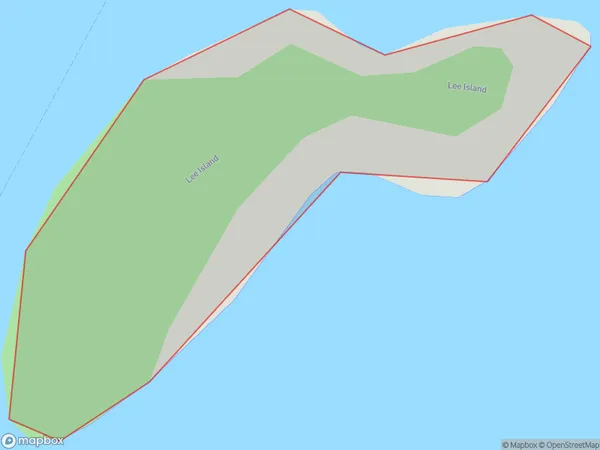
Lee Island Area (estimated)
0.1 square kilometersLee Island Population (estimated)
0 people live in Lee Island, Southland, NZLee Island Suburb Area Map (Polygon)
Lee Island Introduction
Lee Island is located in Fiordland National Park in Southland, New Zealand. It is known for its stunning natural beauty, including rugged mountain landscapes, crystal-clear lakes, and abundant wildlife. The island is a popular destination for hiking, camping, and fishing, with several trails and campgrounds available for visitors.Region
Suburb Name
Lee IslandOther Name(s)
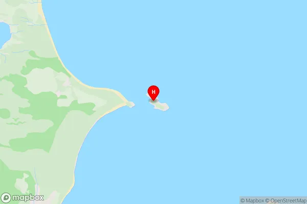
Lake Te AnauLee Island Area Map (Street)
Local Authority
Southland DistrictFull Address
Lee Island, Southland District, New ZealandAddress Type
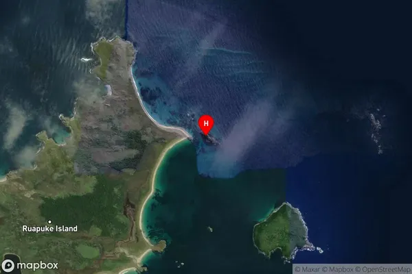
IslandLee Island Suburb Map (Satellite)
Country
Main Region in AU
SouthlandLee Island Region Map

Coordinates
-46.75242035,168.554346604341 (latitude/longitude)Distances
The distance from Lee Island, , Southland District to NZ Top 10 Cities