Rarotoka Island Area, Rarotoka Island Postcode & Map in Rarotoka Island
Rarotoka Island Area, Rarotoka Island Postcode & Map in Rarotoka Island, Southland District,
Rarotoka Island, Southland District,
Rarotoka Island Area (estimated)
1.2 square kilometersRarotoka Island Population (estimated)
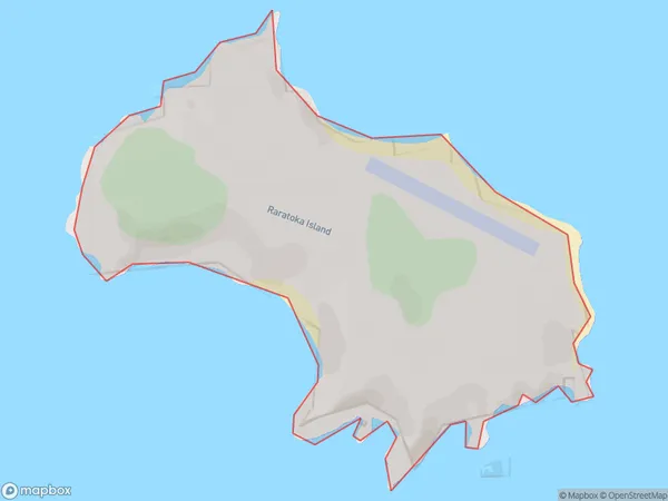
0 people live in Rarotoka Island, Brighton, NZRarotoka Island Suburb Area Map (Polygon)
Rarotoka Island Introduction
Rarotoka Island is a small island in the Otago Harbour, south of Dunedin, New Zealand. It is a popular destination for day trips and has a variety of activities to enjoy, including hiking, biking, and swimming. The island also has a historic village with a church, a school, and a few homes. Rarotoka Island is a great place to relax and escape the hustle and bustle of city life.Region
Major City
Suburb Name
Rarotoka IslandOther Name(s)
Centre Island, Raratoka IslandRarotoka Island Area Map (Street)
Local Authority
Southland DistrictFull Address
Rarotoka Island, Southland District,Address Type
IslandRarotoka Island Suburb Map (Satellite)
Country
Main Region in AU
OtagoRarotoka Island Region Map
Coordinates
0,0 (latitude/longitude)Distances
The distance from Rarotoka Island, , Southland District to NZ Top 10 Cities