Rotoiti Forest Area, Rotoiti Forest Postcode & Map in Rotoiti Forest
Rotoiti Forest Area, Rotoiti Forest Postcode & Map in Rotoiti Forest, Rotorua District,
Rotoiti Forest, Rotorua District,
Rotoiti Forest Area (estimated)
199.5 square kilometersRotoiti Forest Population (estimated)
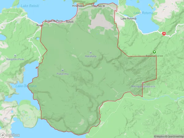
470 people live in Rotoiti Forest, Rotorua, NZRotoiti Forest Suburb Area Map (Polygon)
Rotoiti Forest Introduction
Rotoiti Forest is a forest reserve on the western side of Lake Rotorua in the Bay of Plenty region of New Zealand. It is known for its scenic beauty, including waterfalls, hot springs, and native forests. The forest is home to a variety of wildlife, including the rare and endangered North Island brown kiwi. Visitors can explore the forest on foot, by bike, or on a guided tour.Region
Major City
Suburb Name
Rotoiti ForestOther Name(s)
Gisborne Point, Hinehopu, Rotoehu, Rotoiti, Te HaehaengaRotoiti Forest Area Map (Street)
Local Authority
Rotorua DistrictFull Address
Rotoiti Forest, Rotorua District,Address Type
Locality in City RotoruaRotoiti Forest Suburb Map (Satellite)
Country
Main Region in AU
Bay of PlentyRotoiti Forest Region Map
Coordinates
0,0 (latitude/longitude)Distances
The distance from Rotoiti Forest, Rotorua, Rotorua District to NZ Top 10 Cities