Fuchsia Creek Area, Fuchsia Creek Postcode & Map in Fuchsia Creek
Fuchsia Creek Area, Fuchsia Creek Postcode & Map in Fuchsia Creek, Waitaki District, New Zealand
Fuchsia Creek, Waitaki District, New Zealand
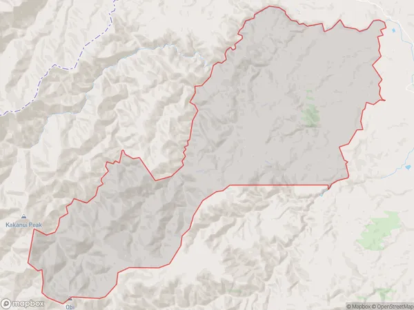
Fuchsia Creek Area (estimated)
207.5 square kilometersFuchsia Creek Population (estimated)
53 people live in Fuchsia Creek, Otago, NZFuchsia Creek Suburb Area Map (Polygon)
Fuchsia Creek Introduction
Fuchsia Creek is a small rural community in the Oamaru district of Otago, New Zealand. It is located on State Highway 1, approximately 20 km south of Oamaru and 125 km north of Dunedin. The community is known for its scenic surroundings, including the Fuchsia Creek Gorge and the Fuchsia Forest. The area has a population of around 100 people and is home to a variety of businesses, including a hotel, a convenience store, and a petrol station. Fuchsia Creek is also a popular destination for outdoor activities such as hiking, fishing, and hunting.Region
Major City
Suburb Name
Fuchsia CreekOther Name(s)
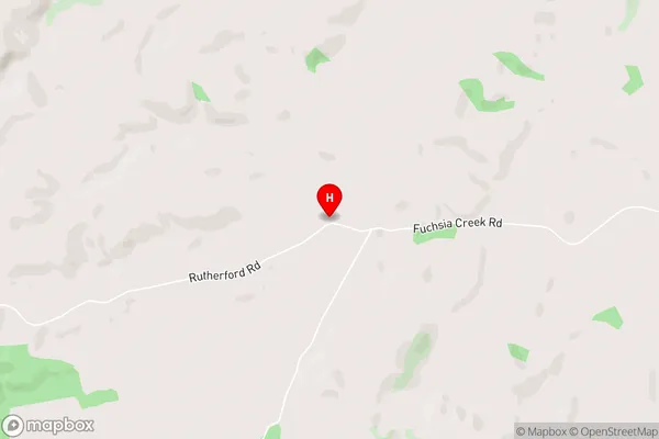
Fuschia CreekFuchsia Creek Area Map (Street)
Local Authority
Waitaki DistrictFull Address
Fuchsia Creek, Waitaki District, New ZealandAddress Type
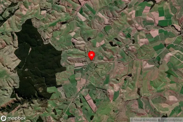
Locality in Town OamaruFuchsia Creek Suburb Map (Satellite)
Country
Main Region in AU
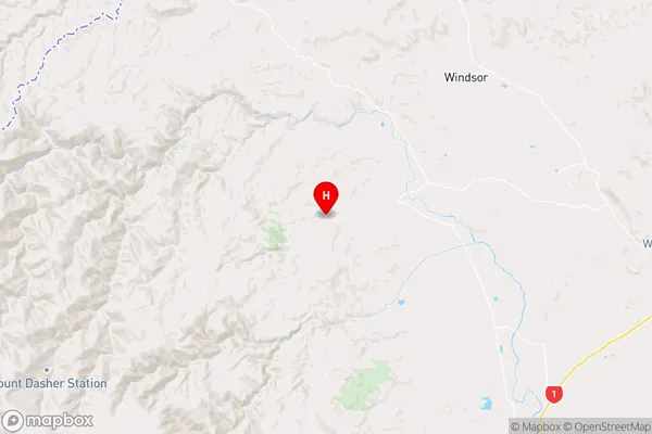
OtagoFuchsia Creek Region Map
Coordinates
-45.0668222,170.7074332 (latitude/longitude)Distances
The distance from Fuchsia Creek, Oamaru, Waitaki District to NZ Top 10 Cities