Wainui Area, Wainui Postcode(4010) & Map in Wainui
Wainui Area, Wainui Postcode(4010) & Map in Wainui, Whakatane District,
Wainui, Whakatane District,
Wainui Postcodes
Wainui Area (estimated)
64.0 square kilometersWainui Population (estimated)
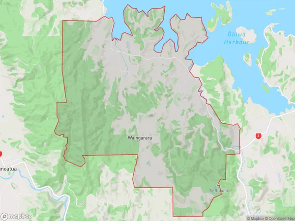
434 people live in Wainui, Whakatane, NZWainui Suburb Area Map (Polygon)
Wainui Introduction
Wainui is a small coastal village in the Bay of Plenty, New Zealand. It is known for its beautiful beaches, clear waters, and stunning natural scenery. The village has a population of around 1,000 people and is a popular destination for tourists and locals alike. Wainui also has a rich cultural heritage, with many historic buildings and sites. The village is located on the eastern coast of the Bay of Plenty, about 25 kilometers from Whakatane. It is surrounded by lush farmland and picturesque forests.Region
Major City
Suburb Name
WainuiOther Name(s)
Cheddar Valley, Kererutahi, WaingararaWainui Area Map (Street)
Local Authority
Whakatane DistrictFull Address
Wainui, Whakatane District,Address Type
Locality in Town WhakataneWainui Suburb Map (Satellite)
Country
Main Region in AU
Bay of PlentyWainui Region Map
Coordinates
0,0 (latitude/longitude)Distances
The distance from Wainui, Whakatane, Whakatane District to NZ Top 10 Cities