Coal Creek Area, Coal Creek Postcode(7802) & Map in Coal Creek
Coal Creek Area, Coal Creek Postcode(7802) & Map in Coal Creek, Grey District,
Coal Creek, Grey District,
Coal Creek Area (estimated)
111.1 square kilometersCoal Creek Population (estimated)
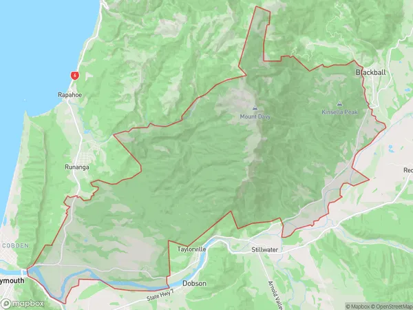
130 people live in Coal Creek, Greymouth, NZCoal Creek Suburb Area Map (Polygon)
Coal Creek Introduction
Coal Creek is a small rural community on the West Coast of New Zealand's South Island. It is located in the Grey District and is known for its coal mining heritage and stunning natural surroundings. The area has a population of around 100 people and is surrounded by lush forests, rivers, and mountains. Coal Creek was once a thriving coal mining town, but the industry declined in the 20th century, leaving behind a legacy of abandoned mines and infrastructure. Today, the community is focused on tourism and agriculture, with visitors coming to explore the area's natural beauty and heritage.Region
Major City
Suburb Name
Coal CreekOther Name(s)
RewanuiCoal Creek Area Map (Street)
Local Authority
Grey DistrictFull Address
Coal Creek, Grey District,Address Type
Suburb in Town GreymouthCoal Creek Suburb Map (Satellite)
Country
Main Region in AU
West CoastCoal Creek Region Map
Coordinates
0,0 (latitude/longitude)Distances
The distance from Coal Creek, Greymouth, Grey District to NZ Top 10 Cities