Rainbow Area, Rainbow Postcode & Map in Rainbow
Rainbow Area, Rainbow Postcode & Map in Rainbow, Marlborough District,
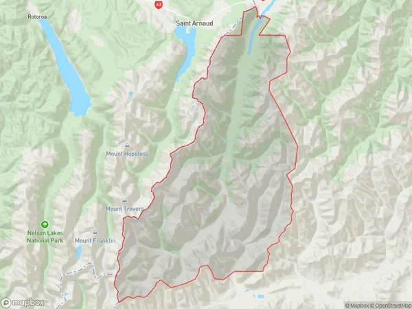
Rainbow, Marlborough District,
Rainbow Area (estimated)
609.9 square kilometersRainbow Population (estimated)
4 people live in Rainbow, , NZRainbow Suburb Area Map (Polygon)
Rainbow Introduction
Rainbow, St. Arnaud, New Zealand, is a small town located in the St. Arnaud Range, surrounded by stunning natural beauty. It is known for its colorful murals and vibrant community spirit. The town has a population of around 1,000 people and is a popular destination for outdoor enthusiasts, with numerous hiking and skiing trails nearby.00Suburb Name
RainbowOther Name(s)
Dip FlatRainbow Area Map (Street)
Local Authority
Marlborough DistrictFull Address
Rainbow, Marlborough District,Address Type
Locality in Major Locality St. ArnaudRainbow Suburb Map (Satellite)
Country
Main Region in AU
Rainbow Region Map
Coordinates
0,0 (latitude/longitude)Distances
The distance from Rainbow, St. Arnaud, Marlborough District to NZ Top 10 Cities