Waihaha Area, Waihaha Postcode(0283) & Map in Waihaha, Ruapehu District
Waihaha Area, Waihaha Postcode(0283) & Map in Waihaha, Ruapehu District, Taupo District,
Waihaha, Ruapehu District, Taupo District,
Waihaha Postcodes
Waihaha Area (estimated)
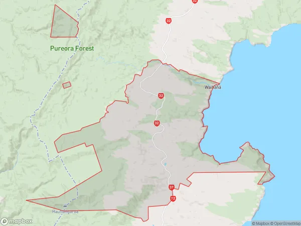
219.3 square kilometersWaihaha Population (estimated)
23 people live in Waihaha, Turangi, NZWaihaha Suburb Area Map (Polygon)
Waihaha Introduction
Waihaha is a small town in the Waikato region of New Zealand, located on the banks of the Waikato River. It is known for its beautiful natural surroundings, including the Waihaha Falls and the Waihaha Forest Park. The town has a population of around 1,000 people and is a popular destination for outdoor activities such as hiking, fishing, and kayaking. It is also home to a number of historic buildings, including the Waihaha Church, which was built in 1878.Region
Major City
Suburb Name
Waihaha (Maori Name: Waihāhā)Other Name(s)
Te Aputa, Te Raina, The Nooks, WhanganuiWaihaha Area Map (Street)
Local Authority
Ruapehu District, Taupo DistrictFull Address
Waihaha, Ruapehu District, Taupo District,Address Type
Locality in Town TurangiWaihaha Suburb Map (Satellite)
Country
Main Region in AU
WaikatoWaihaha Region Map
Coordinates
0,0 (latitude/longitude)Distances
The distance from Waihaha, Turangi, Ruapehu District, Taupo District to NZ Top 10 Cities