Craigieburn Forest Park Area, Craigieburn Forest Park Postcode & Map in Craigieburn Forest Park
Craigieburn Forest Park Area, Craigieburn Forest Park Postcode & Map in Craigieburn Forest Park, Selwyn District,
Craigieburn Forest Park, Selwyn District,
Craigieburn Forest Park Area (estimated)
317.6 square kilometersCraigieburn Forest Park Population (estimated)
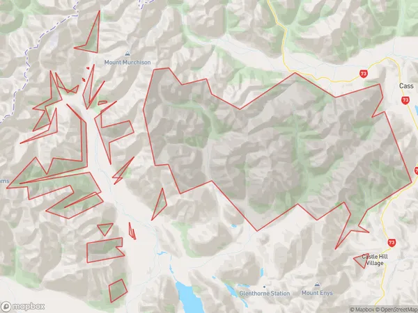
9 people live in Craigieburn Forest Park, , NZCraigieburn Forest Park Suburb Area Map (Polygon)
Craigieburn Forest Park Introduction
Craigieburn Forest Park is a large forest park located in the Craigieburn Range of the Southern Alps in New Zealand. It is a popular destination for outdoor activities such as hiking, mountain biking, and skiing, with over 100 kilometers of tracks and trails. The park is home to a variety of plant and animal species, including kea, tui, and kiwi. It was established in 1948 and is managed by the Department of Conservation.00Suburb Name
Craigieburn Forest ParkOther Name(s)
ColeridgeCraigieburn Forest Park Area Map (Street)
Local Authority
Selwyn DistrictFull Address
Craigieburn Forest Park, Selwyn District,Address Type
Conservation Land in Major Locality Craigieburn Forest ParkCraigieburn Forest Park Suburb Map (Satellite)
Country
Main Region in AU
Craigieburn Forest Park Region Map
Coordinates
0,0 (latitude/longitude)Distances
The distance from Craigieburn Forest Park, Craigieburn Forest Park, Selwyn District to NZ Top 10 Cities