Rotoma Area, Rotoma Postcode & Map in Rotoma
Rotoma Area, Rotoma Postcode & Map in Rotoma, Whakatane District,
Rotoma, Whakatane District,
Rotoma Area (estimated)
152.8 square kilometersRotoma Population (estimated)
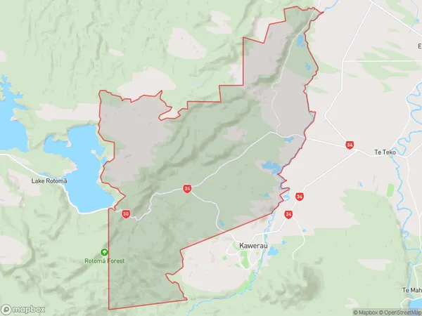
442 people live in Rotoma, Whakatane, NZRotoma Suburb Area Map (Polygon)
Rotoma Introduction
Rotoma is a small town in the Bay of Plenty region of New Zealand. It is known for its historic buildings, including the Rotoma Church, and its scenic location on the banks of the Rotoma River. The town has a population of around 1,000 people and is a popular tourist destination.Region
Major City
Suburb Name
Rotoma (Maori Name: Rotomā)Other Name(s)
Te Waiu O Pukemaire/Braemar SpringsRotoma Area Map (Street)
Local Authority
Whakatane DistrictFull Address
Rotoma, Whakatane District,Address Type
Locality in Town WhakataneRotoma Suburb Map (Satellite)
Country
Main Region in AU
Bay of PlentyRotoma Region Map
Coordinates
0,0 (latitude/longitude)Distances
The distance from Rotoma, Whakatane, Whakatane District to NZ Top 10 Cities