Ataahua Area, Ataahua Postcode(7591) & Map in Ataahua
Ataahua Area, Ataahua Postcode(7591) & Map in Ataahua, Christchurch City,
Ataahua, Christchurch City,
Ataahua Postcodes
Ataahua Area (estimated)
83.9 square kilometersAtaahua Population (estimated)
98 people live in Ataahua, Christchurch, NZAtaahua Suburb Area Map (Polygon)
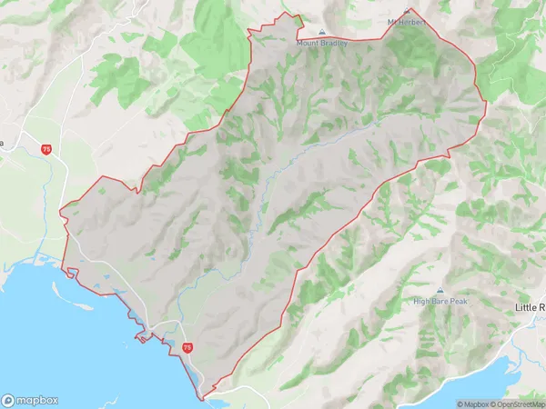
Ataahua Introduction
Ataahua is a small rural community in Tai Tapu, Canterbury, New Zealand. It is located on State Highway 1, 12 km south of Kaiapoi and 35 km north of Christchurch. The area was first settled by Māori in the 13th century and has a rich history of farming and forestry. The village has a primary school, a post office, a church, and a few small businesses. The surrounding countryside is scenic, with rolling hills, farmland, and forests. Ataahua is a popular destination for outdoor activities such as hiking, cycling, and fishing, and is also home to a number of wildlife species, including kea, tui, and kiwi.Region
Major City
Suburb Name
AtaahuaOther Name(s)
Kaituna, Kaituna ValleyAtaahua Area Map (Street)
Local Authority
Christchurch CityFull Address
Ataahua, Christchurch City,Address Type
Locality in Town Tai TapuAtaahua Suburb Map (Satellite)
Country
Main Region in AU
CanterburyAtaahua Region Map
Coordinates
0,0 (latitude/longitude)Distances
The distance from Ataahua, Tai Tapu, Christchurch City to NZ Top 10 Cities