Kaingaroa Forest Area, Kaingaroa Forest Postcode & Map in Kaingaroa Forest
Kaingaroa Forest Area, Kaingaroa Forest Postcode & Map in Kaingaroa Forest, Whakatane District,
Kaingaroa Forest, Whakatane District,
Kaingaroa Forest Area (estimated)
822.6 square kilometersKaingaroa Forest Population (estimated)
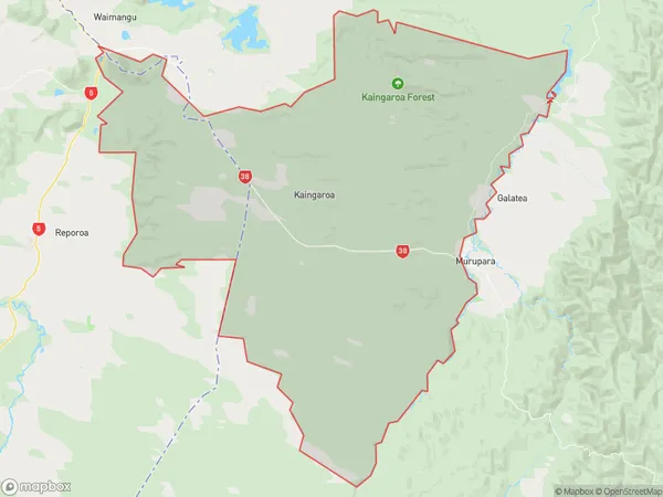
476 people live in Kaingaroa Forest, Whakatane, NZKaingaroa Forest Suburb Area Map (Polygon)
Kaingaroa Forest Introduction
Kaingaroa Forest is a forest located in the Murupara district of the Bay of Plenty region in New Zealand. It is known for its diverse range of plant and animal species, including the Kaingaroa tree, which is the tallest tree in New Zealand. The forest is also home to a variety of bird species, including the kiwi, which is New Zealand's national bird. The forest is a popular destination for tourists and outdoor enthusiasts, with many walking and hiking tracks available.Region
Major City
Suburb Name
Kaingaroa ForestOther Name(s)
Horomanga, Kaingaroa Forest North, Kaingaroa Forest Village, Waiotapu Village, WairapukaoKaingaroa Forest Area Map (Street)
Local Authority
Whakatane DistrictFull Address
Kaingaroa Forest, Whakatane District,Address Type
Locality in Town MuruparaKaingaroa Forest Suburb Map (Satellite)
Country
Main Region in AU
Bay of PlentyKaingaroa Forest Region Map
Coordinates
0,0 (latitude/longitude)Distances
The distance from Kaingaroa Forest, Murupara, Whakatane District to NZ Top 10 Cities