Weber Area, Weber Postcode(4971) & Map in Weber, Central Hawke's Bay District
Weber Area, Weber Postcode(4971) & Map in Weber, Central Hawke's Bay District, Tararua District, New Zealand
Weber, Central Hawke's Bay District, Tararua District, New Zealand
Weber Postcodes
Weber Area (estimated)
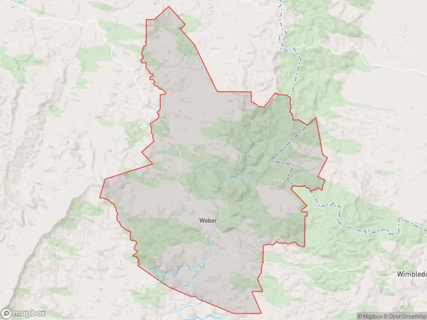
285.9 square kilometersWeber Population (estimated)
161 people live in Weber, Manawatu-Wanganui, NZWeber Suburb Area Map (Polygon)
Weber Introduction
Weber is a small town in Manawatu-Wanganui, New Zealand, with a population of around 1,000 people. It is located on the banks of the Wanganui River and is known for its scenic surroundings and rural charm. The town has a primary school, a post office, a supermarket, and a variety of recreational facilities, including a golf course and a swimming pool. Weber is also home to a number of historic buildings, including the Weber Hotel, which was built in 1887.Region
0Suburb Name
WeberOther Name(s)
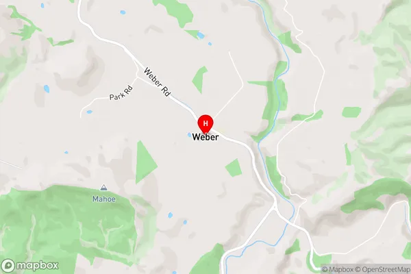
Toi Flat, WaipatikiWeber Area Map (Street)
Local Authority
Central Hawke's Bay District, Tararua DistrictFull Address
Weber, Central Hawke's Bay District, Tararua District, New ZealandAddress Type
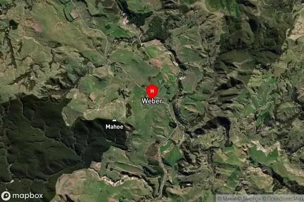
Locality in Major Locality WeberWeber Suburb Map (Satellite)
Country
Main Region in AU
Manawatu-WanganuiWeber Region Map

Coordinates
-40.4021943,176.3111457 (latitude/longitude)Distances
The distance from Weber, Weber, Central Hawke's Bay District, Tararua District to NZ Top 10 Cities