Titirangi Area, Titirangi Postcode(0604) & Map in Titirangi
Titirangi Area, Titirangi Postcode(0604) & Map in Titirangi, Marlborough District,
Titirangi, Marlborough District,
Titirangi Postcodes
Titirangi Area (estimated)
15.9 square kilometersTitirangi Population (estimated)
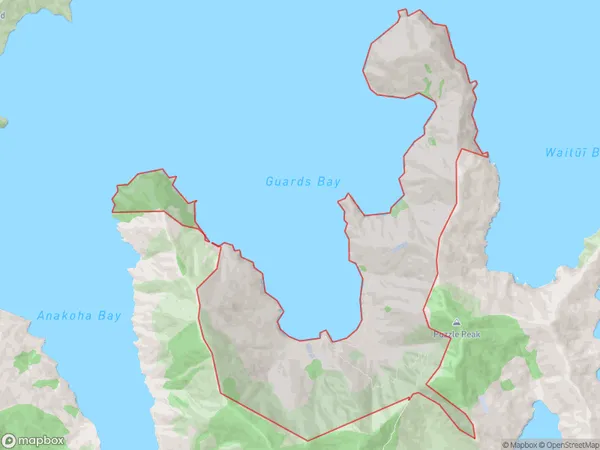
2 people live in Titirangi, , NZTitirangi Suburb Area Map (Polygon)
Titirangi Introduction
Titirangi is a 58.2-hectare (144.2-acre) peninsula in the Marlborough Sounds of New Zealand. It is located 37 km (23 mi) northwest of Blenheim, the region's largest city. The peninsula is home to a variety of wildlife, including native birds, reptiles, and mammals. Titirangi also has several walking and hiking trails, as well as a golf course. The area was named after the Titirangi mountain, which is located on the peninsula's eastern side.0Suburb Name
TitirangiTitirangi Area Map (Street)
Local Authority
Marlborough DistrictFull Address
Titirangi, Marlborough District,Address Type
Locality in Major Locality Marlborough SoundsTitirangi Suburb Map (Satellite)
Country
Main Region in AU
Titirangi Region Map
Coordinates
0,0 (latitude/longitude)Distances
The distance from Titirangi, Marlborough Sounds, Marlborough District to NZ Top 10 Cities