Strowan Area, Strowan Postcode(8140) & Map in Strowan
Strowan Area, Strowan Postcode(8140) & Map in Strowan, Christchurch City, New Zealand
Strowan, Christchurch City, New Zealand
Strowan Area (estimated)
1.6 square kilometersStrowan Population (estimated)
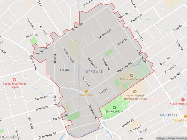
3616 people live in Strowan, Christchurch, NZStrowan Suburb Area Map (Polygon)
Strowan Introduction
Strowan is a suburb of Christchurch, New Zealand, located in the eastern suburbs of the city. It is known for its picturesque gardens, tranquil parks, and well-maintained homes. The suburb has a strong community spirit and is home to a variety of amenities, including a supermarket, medical center, and several schools. Strowan is also well-connected to the rest of Christchurch, with easy access to the city's central business district and public transportation.Region
Major City
Suburb Name
StrowanStrowan Area Map (Street)

Local Authority
Christchurch CityFull Address
Strowan, Christchurch City, New ZealandAddress Type
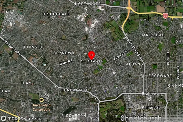
Suburb in City ChristchurchStrowan Suburb Map (Satellite)
Country
Main Region in AU
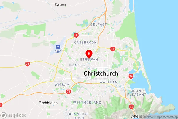
CanterburyStrowan Region Map
Coordinates
-43.5076083,172.6086151 (latitude/longitude)Distances
The distance from Strowan, Christchurch, Christchurch City to NZ Top 10 Cities