Slopedown Area, Slopedown Postcode & Map in Slopedown
Slopedown Area, Slopedown Postcode & Map in Slopedown, Clutha District,
Slopedown, Clutha District,
Slopedown Area (estimated)
353.5 square kilometersSlopedown Population (estimated)
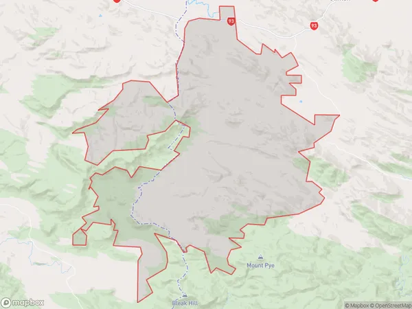
118 people live in Slopedown, Clinton, NZSlopedown Suburb Area Map (Polygon)
Slopedown Introduction
Slopedown is a small rural community in the Otago region of New Zealand. It is located in the Clinton District, approximately 12 kilometers south of the town of Clinton. The area is known for its scenic rural landscapes, including rolling hills, farmland, and picturesque rivers. The community has a population of around 100 people and is home to a variety of businesses and services, including a primary school, a post office, and a convenience store.Region
Major City
Suburb Name
SlopedownSlopedown Area Map (Street)
Local Authority
Clutha DistrictFull Address
Slopedown, Clutha District,Address Type
Locality in Town ClintonSlopedown Suburb Map (Satellite)
Country
Main Region in AU
OtagoSlopedown Region Map
Coordinates
0,0 (latitude/longitude)Distances
The distance from Slopedown, Clinton, Clutha District to NZ Top 10 Cities