Mulgrave Area, Mulgrave Postcode(2756) & Map in Mulgrave, Sydney - Baulkham Hills and Hawkesbury, NSW
Mulgrave Area, Mulgrave Postcode(2756) & Map in Mulgrave, Sydney - Baulkham Hills and Hawkesbury, NSW, AU, Postcode: 2756
Mulgrave, Pitt Town - McGraths Hill, Rouse Hill - McGraths Hill, Sydney - Baulkham Hills and Hawkesbury, New South Wales, Australia, 2756
Mulgrave Postcode
Area Name
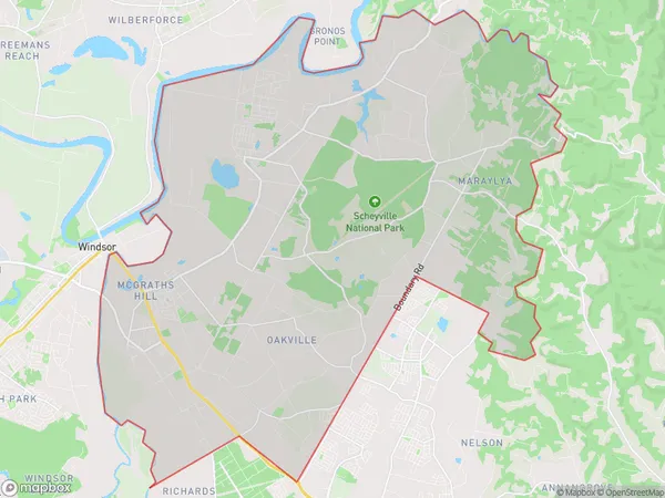
MulgraveMulgrave Suburb Area Map (Polygon)
Mulgrave Introduction
Mulgrave is a suburb in the City of Georges River local government area in Sydney, New South Wales, Australia. It is located 29 kilometres northwest of Sydney's central business district. Mulgrave is part of the Hills District.State Name
City or Big Region
District or Regional Area
Suburb Name
Mulgrave Region Map

Country
Main Region in AU
R3Coordinates
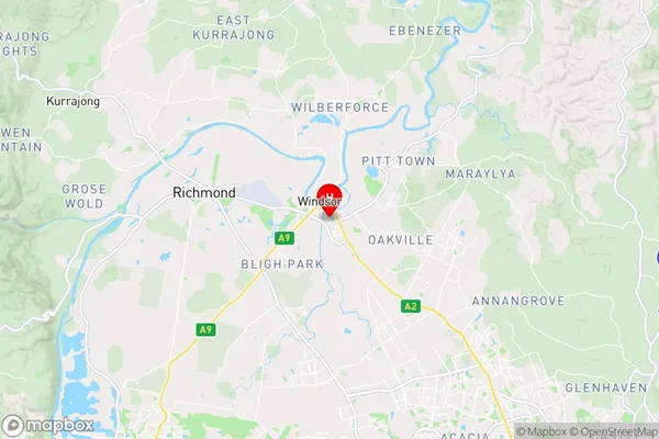
-33.615,150.828 (latitude/longitude)Mulgrave Area Map (Street)
Longitude
150.88744Latitude
-33.466271Mulgrave Elevation
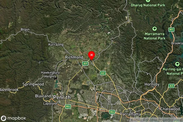
about 93.06 meters height above sea level (Altitude)Mulgrave Suburb Map (Satellite)
Distances
The distance from Mulgrave, Sydney - Baulkham Hills and Hawkesbury, NSW to AU Greater Capital CitiesSA1 Code 2011
11504130102SA1 Code 2016
11504130102SA2 Code
115041301SA3 Code
11504SA4 Code
115RA 2011
1RA 2016
1MMM 2015
1MMM 2019
1Charge Zone
N1LGA Region
The Hills ShireLGA Code
17420Electorate
Macquarie