Rathmines Area, Rathmines Postcode(2283) & Map in Rathmines, Newcastle and Lake Macquarie, NSW
Rathmines Area, Rathmines Postcode(2283) & Map in Rathmines, Newcastle and Lake Macquarie, NSW, AU, Postcode: 2283
Rathmines, Wangi Wangi - Rathmines, Lake Macquarie - West, Newcastle and Lake Macquarie, New South Wales, Australia, 2283
Rathmines Postcode
Area Name
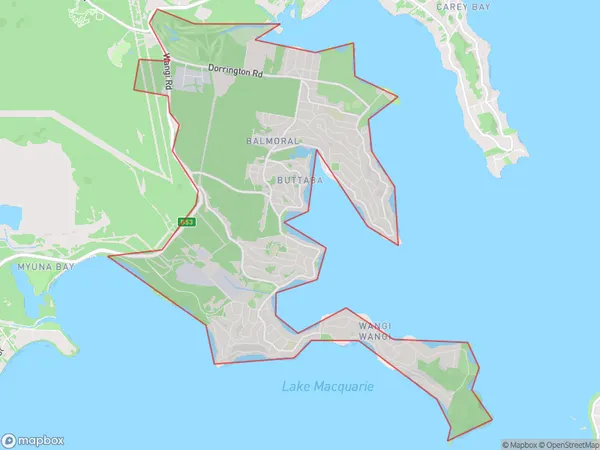
RathminesRathmines Suburb Area Map (Polygon)
Rathmines Introduction
Rathmines, Newcastle, and Lake Macquarie is a suburb in the City of Lake Macquarie, New South Wales, Australia. It is located 28 kilometers (17 mi) west of Newcastle's central business district and is part of the Greater Newcastle region. The suburb has a population of around 38,000 people and is known for its historic architecture, including the Rathmines Post Office and the Rathmines Cottage Hospital. It also has a number of parks and recreational facilities, including the Rathmines Park and the Lake Macquarie Golf Club.State Name
City or Big Region
District or Regional Area
Suburb Name
Rathmines Region Map

Country
Main Region in AU
R2Coordinates
-33.0387657,151.5807689 (latitude/longitude)Rathmines Area Map (Street)

Longitude
151.57181Latitude
-33.019117Rathmines Suburb Map (Satellite)

Distances
The distance from Rathmines, Newcastle and Lake Macquarie, NSW to AU Greater Capital CitiesSA1 Code 2011
11102122008SA1 Code 2016
11102122024SA2 Code
111021220SA3 Code
11102SA4 Code
111RA 2011
1RA 2016
1MMM 2015
1MMM 2019
1Charge Zone
N2LGA Region
Lake MacquarieLGA Code
14650Electorate
Hunter