Elrundie Area, Elrundie Postcode(0822) & Map in Elrundie, Darwin, NT
Elrundie Area, Elrundie Postcode(0822) & Map in Elrundie, Darwin, NT, AU, Postcode: 0822
Elrundie, East Arm, Darwin Suburbs, Darwin, Northern Territory, Australia, 0822
Elrundie Postcode
Area Name
ElrundieElrundie Suburb Area Map (Polygon)

Elrundie Introduction
Elrundie is a small town in the Northern Territory of Australia, located about 100 km north of Darwin. It is known for its natural beauty, including the nearby Elrundie Waterhole and the Elrundie Homestead. The town has a population of around 100 people and is a popular destination for tourists and nature lovers.State Name
City or Big Region
District or Regional Area
Suburb Name
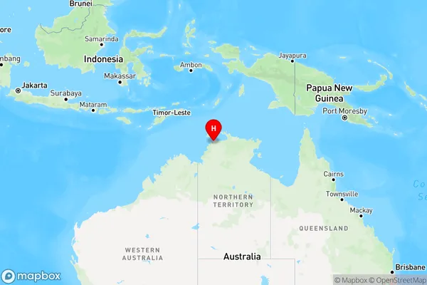
Elrundie Region Map
Country
Main Region in AU
R1Coordinates
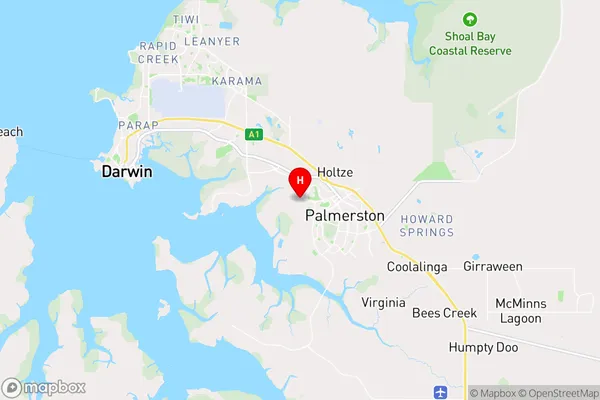
-12.4796,130.96 (latitude/longitude)Elrundie Area Map (Street)
Longitude
130.6254299Latitude
-11.75841975Elrundie Elevation
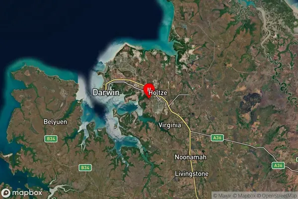
about 15.86 meters height above sea level (Altitude)Elrundie Suburb Map (Satellite)
Distances
The distance from Elrundie, Darwin, NT to AU Greater Capital CitiesSA1 Code 2011
70102101701SA1 Code 2016
70102101701SA2 Code
701021017SA3 Code
70102SA4 Code
701RA 2011
3RA 2016
3MMM 2015
2MMM 2019
2Charge Zone
NT1LGA Region
Tiwi IslandsLGA Code
74050Electorate
Solomon